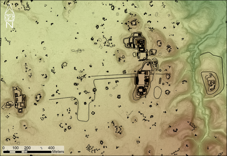
Lidar technology has allowed experts to create a map of the Culloden battlefield, where the last pitched battle on British soil occurred in April 1746.
Conservationists have accurately recreated the Culloden battlefield using electronic mapping techniques, 275 years on from its last battle.
Experts say the new technology gives “the most detailed understanding” possible of how the landscape looked in 1746, when the final Jacobite Rising “came to a brutal head in one of the most harrowing battles in British history”.
Culloden, near Inverness, hosted the final fight of the rebellion where the army of Charles Edward Stuart (Bonnie Prince Charlie) was defeated by a British government force under William Augustus, Duke of Cumberland.
Read the rest of this article...